当冬天来临,我们最盼望的是快点下一场雪!但冬天比你想象的要缤纷多彩。除了皑皑白雪,我们还可以欣赏“雨凇”、“霜花”、“雾凇”……你见过这些自然气象吗?你知道它们的英文表达吗?
 图源:Pexels
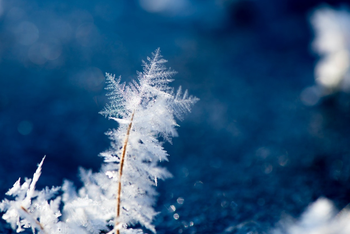
HOAR FROST
白霜
One of the first signs of winter is the hoar frost of late autumn. Deriving its name from an Old English word (hoar, meaning “to appear old”), this is the thin, feathery coating of ice that often forms on objects during cool nights with clear skies. The clear skies allow the ground to lose heat more quickly than the surrounding air, and the humidity in the atmosphere condenses and freezes into a solid when it makes contact with surfaces. This frost can occur even when the air a few feet above ground is well above freezing, and usually melts within an hour or two of sunrise.
深秋的白霜(hoar frost)是预示冬天到来的最早预告。它的英文名来源于一个“古老”的英语单词(hoar,意思是“显得古老”)。白霜是一层薄薄的羽毛状冰层,通常在晴朗的寒夜凝结于物体表面。晴天使地面温度比周围空气的温度下降更快,大气中的湿气在与地面接触时凝结成固体。即使地面上几英尺的空气远高于冰点,也会形成这种冰霜,并且通常在日出后一两个小时内融化。
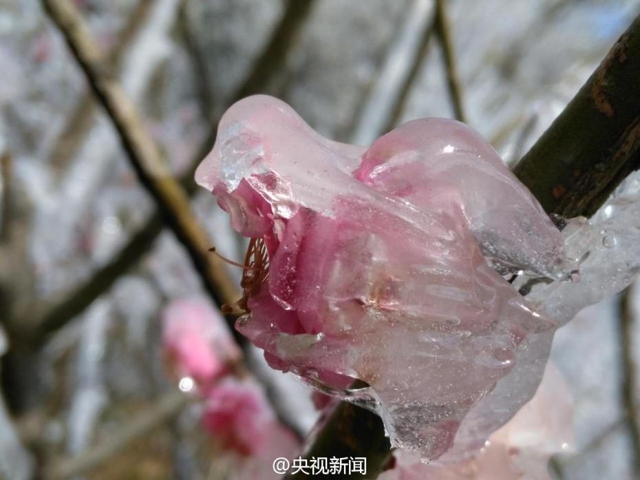
FROST FLOWER
霜花
Frost flowers (and the related “ice ribbons” and “ice beards”) are very thin, spindly, unique formations of ice, seen in late autumn or early winter, when plants are first freezing.
霜花(以及相关的“冰带”和“冰须”)是一种薄而细长、非常独特的冰结构,见于深秋或初冬,植物第一次结冰时。
When the water in the plant stem freezes, it expands to the point where the plant splits open along the side, and the frozen water is extruded from the split. More water is then drawn up through the stem from the ground via capillary action, adding more ice crystals to the frost flower.
当植物茎秆中的水凝结时,会涌到茎秆裂开的地方,冻结的水从裂口中溢出。由于毛细作用,植物的茎从地面吸收更多水分,从而结出更多冰晶的霜花。
 图源:央视新闻
GLAZE ICE
雨凇
When falling precipitation hits a surface that’s below freezing, it can instantly form what’s known as “glaze ice,” a buildup of smooth, clear, and transparent ice. It can be seen coating tree branches and plants following an ice storm.
当雨点落在温度在冰点以下的表面时,会立即形成所谓的“雨凇”,即光滑、透明的冰层。雨雪过后,可见雨凇覆盖在树枝和植物上。
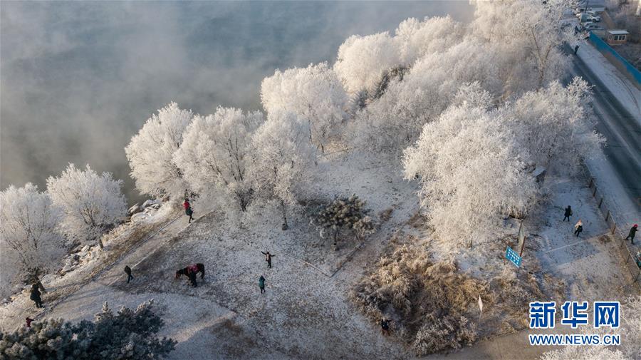
 2018年12月12日,游人在吉林省吉林市丰满区吉丰东路松花江畔观赏雾凇美景。图源:新华网
HARD RIME
硬雾淞
As the weather cools, freezing fogs can occur, and when that fog is combined with wind, hard rime can form on windward (wind-facing) surfaces. “Rime” literally means “hoar frost,” and while slightly different on a meteorological level, “soft rime” is very similar to a thick hoarfrost. Hard rime, on the other hand, is much thicker and harder, and consists of fairly dense pellets of irregular ice crystals glommed together.
随着天气变冷,可能会出现冻雾,当冻雾与风结合时,物体迎风面会形成硬雾凇(hard rime)。Rime字面意思是“白霜”,软雾凇与厚厚的白霜非常相似,但在气象层面上略有不同。此外,硬雾凇要更厚更硬,由高密度的不规则冰晶团聚合在一起形成。
THUNDERSNOW
雷雪
The conditions required to create thundersnow are most common around lakes (it occasionally accompanies lake-effect snow) and coastal areas. In these places, the sun is able to heat the ground and cause relatively warm and humid columns of unstable air to rise up and form turbulent clouds.
在湖泊周围(偶尔出现湖泊效应降雪)和沿海地区最常出现满足雷雪天气的气候条件。在这些地方,阳光让地面温度上升,导致相对温暖潮湿的不稳定空气柱上升,形成湍流云。
But clouds alone don’t make thundersnow. only if the layer of air between the clouds and the ground is warmer than the cloud cover, but still cold enough to create snow, and the wind shear is pushing the warmer air slightly upwards, does thundersnow form.
但光有云层并不能产生雷雪。只有当云层和地面之间的空气层比云层温度高,但仍冷到足以形成降雪,并且风向切变将温暖的空气稍微向上推时,才会形成雷雪。
The snow can often muffle the thunderclap, meaning that many instances of thundersnow probably go unnoticed.
雪通常会掩盖雷声,这意味着许多时候可能听不到雷声。
 图源:Pexels
SNOWPACK
积雪
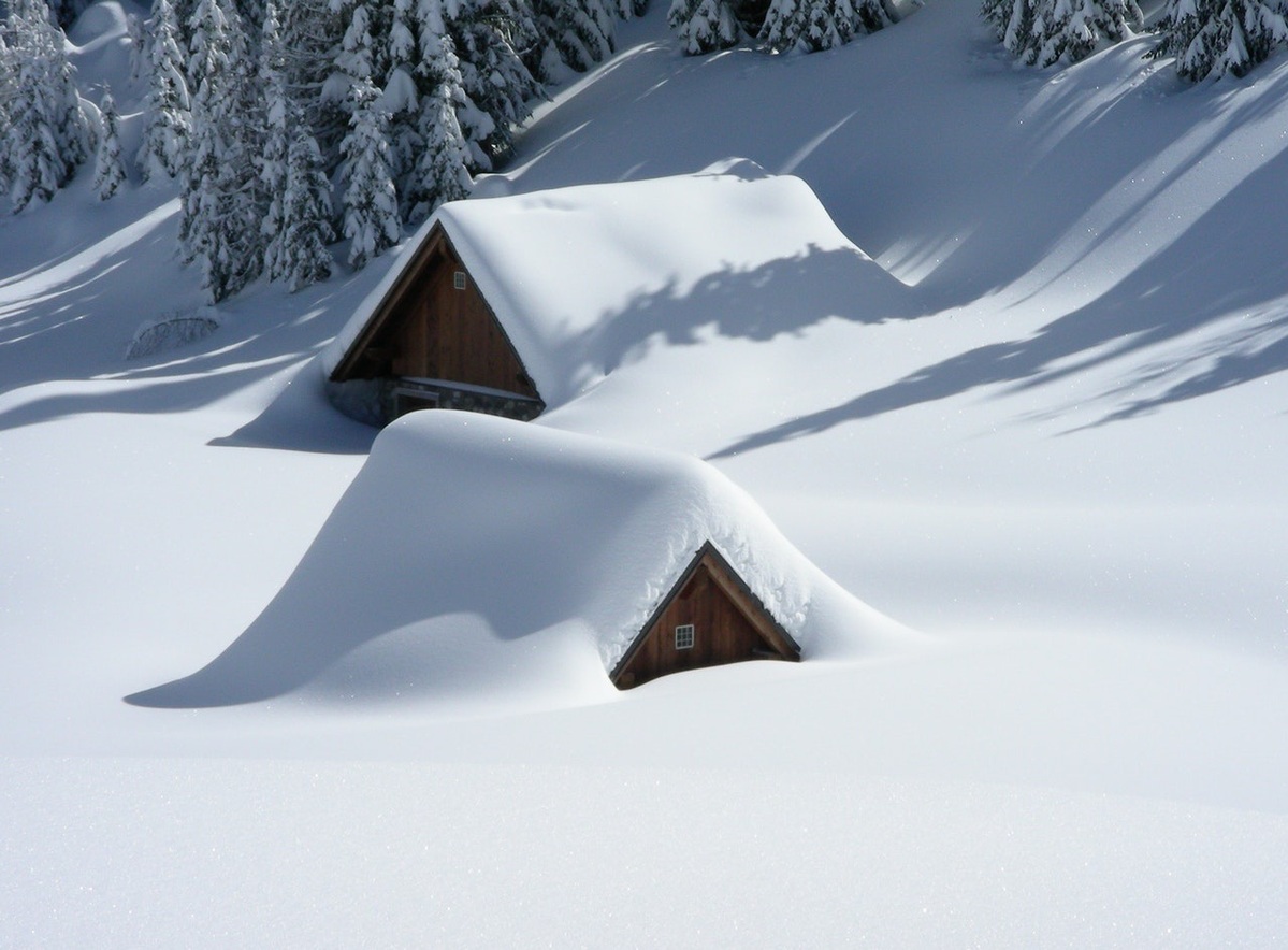
When a place has an extended cold season, snow rarely melts between each subsequent snowfall. Some of it will sublimate—or transition directly from a solid to a gas—especially in areas with lots of sunlight and dry wind, but the majority of it will stay present on the ground. When fresh snow falls on top of the old snow, the crystals of the old snow get packed down under the weight of the new cover. Depending on the length of time, snowflake types, and weather conditions between snowfalls, each layer of the snowpack may have a different thickness and density.
在寒冷季节漫长的地区, 每场雪下完之后都不会融化。其中一些雪会升华(直接从固体转变为气体),特别是在阳光充足和风干燥的地区,但大部分雪会留在地面上。当新雪落在旧雪上面,旧雪的晶体会被新雪覆盖的重量压下来。根据每次降雪间隔的时间长度、雪花类型和天气条件,每层积雪可能具有不同的厚度和密度。
FIRN
粒雪
When years and years of snowpack accumulate, that buildup is called “firn.” It’s much denser than regular snowpack, because of two factors: the partial melting during warmer seasons packs the snow mass closer together; and the new snow falling on top of the ultra-condensed pack pushes the crystals together without melting during the cold season.
当积雪一年又一年堆积起来,就形成了“粒雪”。粒雪比普通积雪密度大得多,这是两个因素导致的:在温暖的季节,一部分雪融化使积雪堆积得更紧密;在寒冷的季节,新雪落在密实的积雪顶部,将晶体推到一起而不融化。
The buildup of firn at high elevations eventually forms glaciers, and replenishes glacial mass to counteract the melting and calving at their lower elevations. The density of firn is between 550830 kilograms per square meter. To put that in perspective, the density of freshly-fallen “powder” snow is around 50 to 70 kilograms per square meter.
高海拔地区的积雪最终形成冰川,并补充冰川物质,以抵消低海拔地区冰川的融化和崩解。粒雪的密度在每平方米550830公斤之间。这是什么概念呢?刚落下的“粉末”雪的密度约为每平方米50至70公斤。
来源:Mental Floss
编辑:董静


